Map of Casco Bay, ME
El's Cards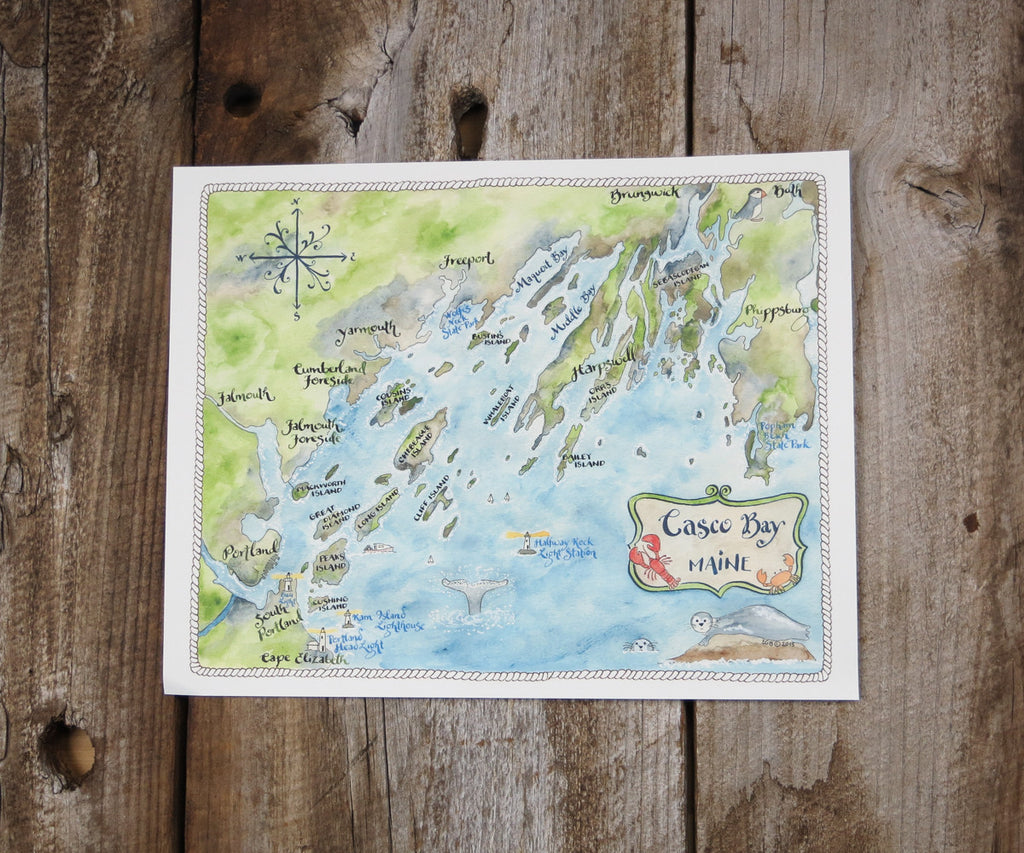

The islands of Casco Bay, Maine are many. This map is done in a soft watercolor style detailing the largest of the islands including Peaks Island, Chebeague, Long Island, and many more. Lighthouses in the area are also highlighted as is Popham Beach State Park.
El’s Cards maps are done in our signature watercolor and calligraphy style. Lots of research goes into creating these fun and whimsical maps of favorite vacation spots and local areas!
- Available as 8x10, 11x14, and now 16x20
- Printed on 80# high quality paper stock
- Presented in a sealed cello sleeve with a 1/16” recycled fiber backing board
- Made in New Hampshire